The NWS Storm Prediction Center (SPC) and local NWS offices continue to highlight a widespread severe weather threat.
The first round of potentially severe storms develops Friday afternoon, moving west-to-east, and extending into the overnight hours ... with the greatest threats occurring over northeastern Louisiana. Severe threats are on the lower-end ("Marginal Risk") for a majority of the state during this period.
There could be a lull in the action during pre-dawn and early morning hours on Saturday. However, guidance indicates that the atmosphere will be primed for action, and developing thunderstorms on Saturday could blow-up and become "severe" relatively quickly. All modes of severe storms are expected on Saturday.
Expect Tornado Watch(es?) to be issued Saturday morning for much/most of the state.
This set-up not only could result in widespread severe storms and numerous Warnings through the day ... but the SPC is noting some of the severe storms will have the potential of producing hail of 2" or more, winds dusting over 75 mph, and 'strong' long-tracked tornadoes.
Current forecast timing for Saturday brings the threat to an end from west-to-east: in the morning for western parishes, during the mid-day to afternoon for central parishes, and into the evening for southeast Louisiana.
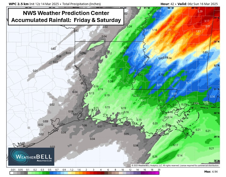
Localized downpours could produce some pockets of nuisance standing water but the NWS Weather Prediction Center outlook currently keeps regional rain totals under 1.0" for most parishes.
Jay Grymes
State Climatologist